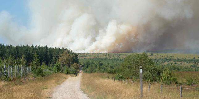
When a high-velocity wildfire descends upon a densely populated Mediterranean tourism corridor, the resulting crisis is rarely just an environmental event. It is a system failure rooted in wind dynamics, topographical amplification, and municipal evacuation bottlenecks. The recent disaster along Croatia's Dalmatian coast, centered around the towns of Omiš and Lokva Rogoznica, lays bare the mechanical limits of modern fire suppression when confronted with extreme atmospheric conditions.
To understand why traditional firefighting assets frequently fail in these environments, one must deconstruct the operational variables that dictate fire spread speed, structural ignition vectors, and human evacuation friction.
The Physical Drivers of Rapid Coastal Propagation
The destruction observed across more than a thousand hectares of Dalmatian pine forests and residential peripheries was governed by three compounding physical forces: thermal updrafts, wind-driven spotting, and low fuel moisture content driven by prolonged regional heatwaves.
The topography of the Adriatic coast acts as a natural thermal chimney. As air masses heat over the rocky limestone hillsides, low-pressure zones pull marine air inward while creating erratic, high-speed localized wind vectors. When a fire initiates in areas like Lokva Rogoznica, these winds do not merely push the fire front forward; they elevate burning embers into the atmosphere, causing secondary ignitions hundreds of meters ahead of the main front.
This mechanism bypasses primary firebreaks, rendering perimeter defense strategies obsolete. Standard ground units cannot reposition fast enough to counter a fire front that scales vertical terrain at lightning speed. While aerial assets such as Canadair water bombers provide critical cooling interventions, their deployment window is strictly limited by smoke density, wind shear, and water source proximity.
The Urban Interface Vulnerability Matrix
The transition zone where dense residential development meets native pine forest creates an unstable fuel complex. In tourist-heavy coastal towns like Omiš—where baseline permanent populations swell significantly due to seasonal tourism inflows—the vulnerability matrix expands exponentially:
- High Density and Narrow Arteries: Historic coastal layouts feature narrow roads designed centuries ago, creating immediate gridlock when thousands of residents and tourists attempt to evacuate simultaneously.
- Building Material Flammability: Older structures and modern homes alike feature exposed timber, plastic outdoor furnishings, and unshielded eaves that act as catch-points for wind-borne embers.
- Vehicular Fuel Loads: Parked cars lining narrow coastal access roads frequently ignite from radiant heat or direct flame contact, turning escape routes into physical blockades and producing toxic petroleum-based smoke that incapacitates evacuees.
Hospital admissions following the Dalmatian coast disaster confirm that severe burns and smoke inhalation among both locals and international visitors stem directly from delayed evacuation windows rather than direct structural entrapment. When individuals delay departure to protect property, they encounter blocked escape corridors as vehicles melt and power lines fail.
Emergency Response Constraints and Triage Mechanics
Civil protection authorities operate under strict operational constraints during fast-moving crown fires. The deployment of hundreds of firefighters and specialized vehicles is heavily constrained by accessibility. When a primary coastal highway is severed by flames or debris, reinforcement transit times double, starving active fronts of necessary water and personnel.
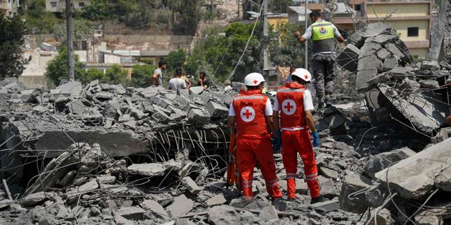
Medical triage during these events follows a brutal prioritization curve. Emergency services treating dozens of casualties—including severe trauma and life-threatening respiratory distress cases—must establish forward-operating stabilization points outside the immediate hazard zone, often relying on makeshift shelters like municipal sports halls for mass temporary accommodation. This decentralized response fractures communication channels between local police, regional fire commands, and national rescue coordinators.
Tactical Mitigation for High-Risk Coastal Corridors
To prevent similar catastrophic outcomes in vulnerable Mediterranean zones, municipal planning must shift from reactive suppression to structural hardening.
Property owners and local governments must establish non-combustible buffer zones extending at least thirty meters from primary structures, clearing dead biomass and replacing highly flammable ornamental vegetation with fire-resistant deciduous species. Road infrastructure along tourist-dense corridors requires mandatory emergency turn-arounds, automated gate releases, and strict summer parking bans on narrow evacuation arteries.
Emergency management agencies must abandon voluntary evacuation models during extreme red-flag weather events. Automated, mandatory geolocated evacuation alerts tied to real-time wind speed telemetry must be deployed at the first sign of ignition in high-risk topographies to decouple human flight time from fire arrival time.
Omis Croatia Wildfire Update & Devastating Aftermath
This video provides on-the-ground visual documentation of the damage and emergency response following the wildfire on the Croatian coast.