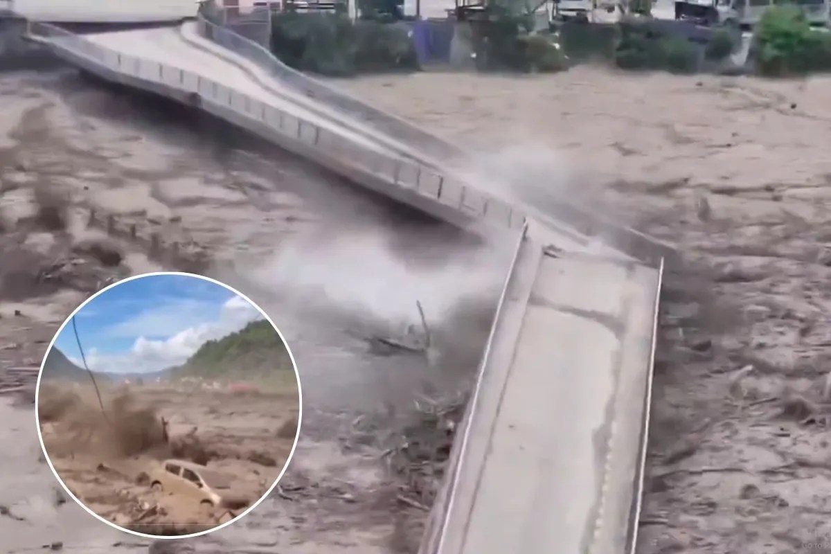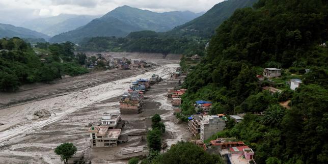
Geographic concentration combined with extreme weather dynamics triggers systemic failure across vulnerable river basins. When monsoon anomalies converge on the topography of Nepal and Tibet, the resulting hydro-meteorological shocks expose critical vulnerabilities in regional infrastructure, early warning mechanisms, and disaster response protocols. Recent catastrophic floods leaving nearly a hundred confirmed fatalities and hundreds missing serve as an empirical stress test for the structural integrity of human settlements along major Himalayan river corridors.
Disaster response in high-altitude environments requires a departure from reactive crisis management toward proactive structural mitigation. The traditional approach relies on post-event allocation of emergency relief, ignoring the underlying vulnerabilities that convert natural precipitation events into humanitarian catastrophes. Evaluating the mechanics of these events demands a multi-variable framework encompassing meteorological triggers, hydrological response functions, and socio-economic exposure vectors.
The Meteorological Trigger Matrix
Monsoon intensification in the Hindu Kush Himalaya region operates on a distinct thermodynamic feedback loop. Warmer atmospheric temperatures increase moisture retention capacity, which intensifies convective activity along high-altitude barriers. When these moisture-laden air masses collide with the Himalayan orographic wall, they produce high-intensity precipitation events concentrated over narrow catchment zones.
Precipitation volume alone does not determine flood severity. The temporal distribution of rainfall dictates the runoff coefficient. High-intensity downpours over compressed time horizons saturate soil profiles instantly, shifting the hydrological regime from infiltration-dominant to saturation-excess overland flow. Soil stability on steep mountain gradients degrades rapidly under these conditions, initiating secondary hazards such as shallow landslides and debris flows.
Debris flows fundamentally alter river hydraulics. When millions of cubic meters of rock, soil, and vegetation enter narrow gorges, they create temporary landslide dams. The subsequent breach of these natural impoundments generates a destructive surge wave that travels downstream at velocities far exceeding normal flood propagation rates. Traditional river gauge networks often fail to capture these sudden surges because the debris destroys instrumentation before telemetry data can be transmitted.
Hydrological Vulnerability and Infrastructure Deficits
Human habitation patterns along Himalayan river corridors evolved historically around agricultural fertility and trade routes, placing critical infrastructure directly within active floodplains. Modern development has accelerated this concentration without proportional upgrades to hazard mapping and zoning enforcement.
Bridges, hydropower facilities, and arterial roads frequently operate under hydraulic parameters designed for historical discharge frequencies that no longer apply under accelerated climatic variability. The margin of safety built into these structures assumes stationary climatic conditions, whereas current hydrological regimes exhibit high non-stationarity.
- Hydraulic Bottlenecks: Narrow valley configurations restrict lateral expansion of floodwaters, forcing vertical escalation of peak stage heights and maximizing destructive shear stress on riverbanks.
- Sediment Aggradation: Upstream erosion deposits massive sediment loads in lower gradient reaches, raising riverbeds and reducing channel capacity over successive monsoon cycles.
- Infrastructure Interdependency: Failure of a single upstream bridge or diversion weir creates cascading blockages, transforming localized high water into a destructive battering ram of debris.
Engineering countermeasures must shift from hard structural defenses to adaptive catchment management. Concrete river walls frequently fail because they concentrate hydraulic energy rather than dissipating it. Sustainable mitigation requires sediment retention basins, controlled retention zones in wider valley floors, and strict setback regulations for permanent structures.
Early Warning System Bottlenecks
An effective early warning system requires three integrated components: reliable real-time data acquisition, rapid predictive modeling, and absolute last-mile communication fidelity. The failure of any single component neutralizes the entire architecture.
Data acquisition networks in remote Himalayan terrain suffer from high maintenance costs, vulnerability to extreme weather, and limited spatial density. Telemetry reliant on cellular networks breaks down during regional power outages triggered by storms. Satellite-based communication arrays offer redundancy but introduce latency and higher operational overhead.
Predictive modeling faces severe friction due to micro-climatic complexity. Standard numerical weather prediction models lack the resolution to forecast localized cloudbursts in deep valleys. Consequently, forecasting shifts from predictive meteorological modeling to reactive hydrological monitoring, where warning times shrink from hours to mere minutes.
The communication bottleneck represents the most critical point of failure in remote communities. Sirens and automated text alerts are ineffective if local populations lack pre-established evacuation protocols or fail to recognize the physical precursors of flash floods. Effective dissemination relies on decentralized community-based disaster risk reduction networks that pair technological alerts with indigenous risk perception.
Socio-Economic Exposure Vectors
Vulnerability is fundamentally a function of exposure and adaptive capacity. Rural communities in Nepal and Tibet often exhibit high exposure due to geographic constraints and high adaptive deficit driven by economic marginalization.
Subsistence economies leave little surplus for resilient housing construction or relocation away from hazard zones. When catastrophic floods destroy agricultural land and irrigation canals, the economic shock reverberates across multiple years, driving cyclical poverty and forced migration.
Transboundary coordination adds another layer of complexity. Himalayan river basins are inherently transnational, with watersheds originating in the Tibet Autonomous Region of China and flowing through Nepal into India. Hydrological data sharing and joint hazard management protocols remain inconsistent due to geopolitical friction and varying institutional capacities. A flood wave does not respect international borders; effective mitigation requires unified hydrological data integration across the entire basin.
Strategic Resource Allocation and Operational Realignment
Mitigating recurring catastrophe in the Himalayan corridor requires a permanent shift in capital allocation priorities. Funding must pivot away from emergency reconstruction of vulnerable assets in hazard-prone locations and toward systemic risk reduction and territorial restructuring.
Governments and international development banks must implement comprehensive multi-hazard risk mapping enforced through binding land-use regulations. Infrastructure investments should incorporate climate-resilient design standards that account for non-stationary hydrological extremes. Concurrently, regional authorities must establish formal transboundary data-sharing agreements to ensure upstream monitoring data reaches downstream communities with maximum lead time. The operational focus must remain on hardening the weakest links in the socio-technical disaster response chain before the next monsoon cycle tests regional resilience once more.