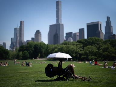
The Eastern United States is currently trapped in a suffocating pressure cooker. If you’ve stepped outside today in DC, Philly, or New York, you know the feeling. The air isn't just hot; it’s heavy. It’s that thick, soup-like humidity that makes a three-block walk feel like a marathon. We’re seeing temperatures redlining in the 90s, with heat indices pushing well into the triple digits. But there's a massive shift on the horizon. A powerful cold front is barreling toward the coast, and while it brings the promise of relief, it’s going to arrive with a literal bang.
You’re likely exhausted from the relentless sun. I get it. This kind of stagnant heat isn't just uncomfortable; it’s a genuine health hazard that puts immense strain on our power grids and our bodies. The National Weather Service has issued heat advisories across a massive swath of the I-95 corridor because the "real feel" temperatures are hitting levels that can cause heatstroke in minutes.
The Physics of Why We Are Sweating So Much
This isn't just a "hot summer day." We’re dealing with a specific meteorological setup called a "heat dome." High pressure has parked itself over the Atlantic coast, acting like a lid on a pot. It traps the heat and prevents cooler air from circulating. Because the ground is dry in many of these areas, the sun’s energy goes directly into heating the air rather than evaporating moisture from the soil.
When you add the moisture pumping in from the Gulf of Mexico, the dew points skyrocket. Once dew points hit 70 degrees, the human body struggles to cool itself through sweat. It’s basic biology. Your sweat doesn't evaporate, so your internal temperature stays high. That's why today feels so much more dangerous than a dry heat in the desert.
The Cold Front is Charging In
Relief is coming, but it won't be a quiet transition. A deep trough of low pressure is moving through the Great Lakes and heading East. This is a classic clash of air masses. You have the hot, unstable air currently sitting over the East Coast meeting a wall of much cooler, denser air from Canada.
When these two collide, the hot air is forced upward violently. This is the recipe for severe thunderstorms. As the front moves through tonight and tomorrow, we’re looking at the potential for damaging winds, frequent lightning, and localized flash flooding. The transition won't be a gentle breeze; it’ll be a series of storms that could knock out power in areas already stressed by high AC usage.
The temperature drop will be staggering. We’re talking about a 20-degree swing in some cities within 24 hours. By Friday, those 95-degree highs will be replaced by mid-70s. It’s the kind of weather that makes you want to open every window in the house.
Why Cities Feel the Burn More Than Suburbs
If you live in a downtown area, you’re experiencing the Urban Heat Island effect. It’s not your imagination; it really is 5 to 10 degrees hotter in the city than in the surrounding countryside. Asphalt, brick, and concrete soak up solar radiation all day and then bleed that heat back into the air all night.
This means the "lows" at night aren't actually low. When the temperature stays above 80 degrees at 3:00 AM, your body never gets a chance to recover from the daytime stress. This cumulative heat stress is what leads to the highest rates of hospitalizations during these events.
- Check on your neighbors: Seriously. Elderly residents in buildings without central air are the most at risk.
- Pet safety: If the pavement is too hot for your hand, it's too hot for their paws.
- Hydration: Drink water before you feel thirsty. If you're thirsty, you're already behind.
Preparing for the Stormy Shift
Since the heat is about to break via severe weather, you need to prep for the "in-between" phase. High-wind warnings usually accompany these types of cold fronts.
- Secure your outdoor gear: Those patio umbrellas and lightweight chairs will become projectiles once the front hits.
- Charge everything: With the grid already taxed, a sudden thunderstorm can easily trip transformers. Get your phones and backup batteries to 100% now.
- Clean your gutters: The rain coming with this front will be intense and fast. If your gutters are clogged with spring debris, you’re looking at a flooded basement.
The atmospheric energy available for these storms is off the charts. Meteorologists look at a metric called CAPE (Convective Available Potential Energy). Right now, the CAPE values along the East Coast are incredibly high. This means any storm that does form has the "fuel" to become a monster very quickly.
The Long Term Outlook
Is this the end of summer heat? Hardly. While this specific cold front provides a beautiful window of relief for the upcoming weekend, the long-range models suggest the ridge of high pressure will try to rebuild by the following week.
However, this break is vital. It allows the soil to soak up some much-needed moisture and gives the electrical grid a "cool down" period to perform necessary maintenance. Enjoy the 70-degree weather while it lasts.
Don't wait for the rain to start before you take action. Clear those storm drains on your street if they’re covered in trash or leaves. If you're planning on traveling along the I-95 corridor tomorrow, keep a weather app open. The timing of these fronts can shift by a few hours, and you don't want to be caught on the highway during a microburst or a severe squall line. Stay hydrated for the next six hours, then get ready to grab a light jacket for Friday morning.