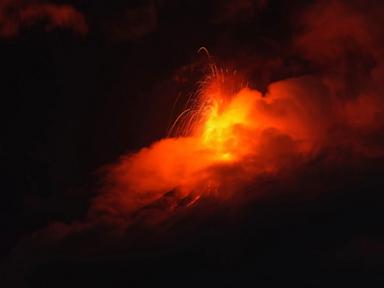
When the earth opens up just 33 miles from a major capital city, people pay attention. Guatemala's Volcán de Fuego, known locally as the Volcano of Fire, entered a violent explosive phase that sent columns of ash soaring more than 23,000 feet into the atmosphere. Red alerts went live, highways shut down, and roughly 1,700 residents packed bags to flee the slopes. Now, official reports show the explosive fury is starting to fade.
Don't let the drop in immediate seismic drama fool you. A cooling crater doesn't mean safety. Expanding on this topic, you can find more in: Why Shri Thanedar Did Not Lose Because of Politics.
The False Sense of Security on the Slopes
Disaster authorities like CONRED are fighting a constant battle against human nature. As soon as the raw spectacle of lava fountains and glowing rock calms down, evacuees start drifting back home. They check on their livestock. They worry about empty houses. They assume the danger has passed entirely.
That mindset is terrifyingly common, and it gets people killed. Observers at The Guardian have also weighed in on this matter.
Living in the shadows of a 12,300-foot stratovolcano means dealing with delayed-action hazards. When heavy rain mixes with fresh ash deposits sitting on steep mountain flanks, you get lahars. These volcanic mudflows move fast, hit hard, and carry enough weight to crush buildings into matchsticks. A tropical wave bringing rain from the east right now poses just as much threat as the initial eruption.
Why Fuego Refuses to Stay Quiet
Central America sits squarely on the Pacific Ring of Fire, making geological volatility a daily reality. But Fuego stands out even among aggressive peaks. It is relentlessly active.
Think back to the catastrophic June 2018 eruption that wiped entire communities off the map. Survivors remember how fast pyroclastic flows moved. They didn't have hours to pack. They had seconds. That tragedy changed how local monitoring agencies operate, pushing officials toward aggressive preventive evacuations the moment orange or red alerts trigger.
When Insivumeh—Guatemala's Institute of Volcanology—reports dozens of tectonic tremors coupled with towering lava fountains reaching nearly 1,000 feet high, the protocol must be absolute compliance. Yet, thousands of families remain caught in a cycle of seasonal panic. They evacuate to temporary shelters in places like San Juan Alotenango or Escuintla, wait out the peak phase, and then roll the dice by heading back up the mountain.
Navigating the Ongoing Threat
If you are tracking emergency management protocols in disaster-prone regions, the takeaway here goes beyond a single news cycle. Early warning systems work, but community retention during recovery phases remains broken.
Volcanic safety requires managing three distinct phases:
- The Active Eruption: Immediate evacuation, airspace monitoring, and highway closures to protect against falling tephra and lava tongues.
- The Weather Window: Tracking incoming rain fronts that turn loose ash into concrete-like mudflows sweeping through river valleys.
- The Return Phase: Enforcing structural re-entry bans until geologists clear the drainage channels.
Governments cannot rely solely on temporary shelters. Long-term relocation incentives for families living in high-risk red zones are the only permanent fix. Until infrastructure catches up with nature's volatility, Fuego will keep forcing the same painful cycle of flight, relief, and hazardous return. Keep a close eye on regional weather updates if you have ties to the area, because the rain poses a danger long after the fire stops.