April usually brings that mild, breezy transition toward summer or winter depending on where you're standing. Not this year. Right now, Spain and Brazil are sweating through a late April that looks more like the peak of July. If you think the weather feels "off," you're right. We're seeing temperature spikes that aren't just slightly above average—they're breaking the scale.
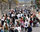
In Spain, the mercury is hitting 34°C in places like Seville. That's about 9°C higher than what locals usually expect this time of year. Across the Atlantic, Brazil is bracing for the high 30s in states like São Paulo and Paraná. This isn't just a "nice sunny day." It’s a systemic shift that's pushing infrastructure and human health to the brink.
The Saharan Dust and the Spanish Oven
Spain is currently trapped in a perfect storm of atmospheric conditions. A low-pressure system sitting out in the Atlantic is acting like a giant fan, pulling hot air straight from North Africa across the Iberian Peninsula.
It isn't just the heat, though. This south-westerly flow is dragging a massive plume of Saharan dust with it. If you've seen photos of orange or blood-red sunrises in Madrid or Seville this week, that's why. The dust makes for great photos, but it’s a nightmare for anyone with respiratory issues.
The numbers are startling. Madrid is seeing 30°C on a Tuesday in April. For context, that’s 10°C above the norm. When you’re 10 degrees off the baseline, you aren't just having a warm spell; you're living in a different climate zone.
Why Spain is Heating Up So Fast
- The Atlantic Low: The positioning of this system is critical. It creates a "corridor" for tropical air.
- Saharan Influence: The proximity to the desert means that when the wind shifts south, Spain becomes an extension of the Sahara.
- Dry Soil: Previous dry spells mean there’s less moisture in the ground to evaporate and cool the air, leading to a feedback loop of rising heat.
Brazil’s Urban Heat Islands are Screaming
While Spain deals with desert winds, Brazil is fighting a different beast. In states like São Paulo, Mato Grosso do Sul, and Santa Catarina, the heat is becoming localized and intense. We’re talking about maximums in the high 30s, which is 5-10°C above the seasonal average.
The real danger in Brazil isn't just the raw temperature; it’s the humidity and the "heat island" effect in cities. When you combine 38°C heat with the concrete and asphalt of a metropolis like São Paulo, the "felt" temperature—what it actually feels like on your skin—can skyrocket.
[Image showing the urban heat island effect where city centers are significantly warmer than surrounding rural areas]
In late 2025 and early 2026, projections already warned that this year would be among the hottest since 1850. We're seeing that play out now. The World Meteorological Organization (WMO) has been tracking a transition toward ENSO-neutral conditions, but the residual heat in the oceans and the atmosphere is keeping the "oven" turned on.
The Global Context of the April Anomaly
You might think these are isolated events, but they’re part of a broader, more aggressive global trend. 2024 was already the hottest year on record, and 2026 is currently chasing that title.
The "spring predictability barrier" usually makes it hard for meteorologists to be certain about the second half of the year, but the data we have now is grim. We're looking at a world that is consistently 1.3°C to 1.5°C above pre-industrial levels. April is just the latest victim.
Beyond Spain and Brazil
It’s not just these two. Look at North America. Montana and the Dakotas are seeing temperatures 15°C above the norm this week. While Spain swelters, parts of the US Midwest are watching the mercury climb to summer levels before the flowers have even fully bloomed.
Conversely, some regions are getting the "equal and opposite" reaction. Southern Africa, specifically Botswana and South Africa, are dealing with severe thunderstorms and localized flooding. When the atmosphere holds more heat, it holds more moisture. When that moisture drops, it doesn't just rain; it pours.
What This Means for Your Daily Life
This isn't just a topic for climate scientists or people who like to look at maps. These spikes change how we live.
- Energy Grids: Expect power surges as people crank the AC earlier than usual. This leads to higher bills and potential blackouts.
- Health Risks: Late April heat is dangerous because our bodies haven't "acclimatized" yet. We aren't ready for 34°C in the way we are in August.
- Agriculture: Early heat can trick plants into blooming too soon, leaving them vulnerable to any late-season cold snaps.
Keep an eye on local wet-bulb temperatures if you’re in Brazil. If the humidity is high, your body can’t sweat effectively to cool down. In Spain, stay indoors during the peak dust concentrations to protect your lungs. This weather isn't just "unusual"—it's the new baseline we have to navigate.
Check your local weather alerts twice a day. The speed at which these systems are moving means a "warm afternoon" can turn into a record-breaking heatwave in less than 24 hours. Don't get caught off guard.